
What the Indore Master Plan 2035 Means for Homeowners

Most people in Indore have heard the term "Master Plan 2035" but don't actually know what's in it or how it affects their home, plot, or construction plans.
Here's the direct version — what it is, what's changing, and what it means for you specifically.
What Is the Master Plan 2035?
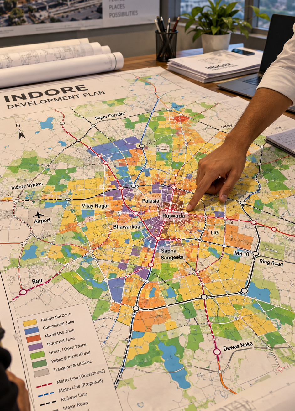
The Indore Master Plan 2035 is an official city development blueprint prepared by the Town and Country Planning (T&CP) Department and the Indore Development Authority (IDA). It defines:
Which areas can be used for what purpose — residential, commercial, industrial, mixed-use
Where roads, metro lines, and infrastructure will be built
How much you can build on your plot (FAR, coverage limits)
Which new zones are being opened for development
It replaces the expired 2021 plan and is slated for full implementation now. The plan targets Indore's population growing from 35 lakh today to over 80 lakh by 2035 — which is the single biggest reason property values are moving the way they are.
1. Massive Land Allocated for Housing
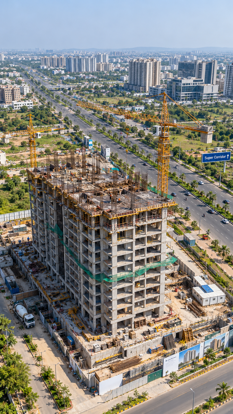
The Master Plan 2035 allocates 15,795 hectares specifically for housing — the largest single land use category in the plan. This signals where the city is expanding and where residential construction will be permitted and supported.
What this means for you:
New residential zones are being opened in areas that were previously agricultural or unplanned — especially in Rau, Mhow, Sanwer, and peripheral areas around the Super Corridor
Plots in newly notified residential zones will require updated approvals under the 2035 plan guidelines — the old 2021-era approvals may not apply
If you own agricultural land in expanding zones, check the updated land use designation before assuming you can build residential on it
2. Vertical Development — Build Higher Than Before
One of the 17 foundation principles of the Master Plan 2035 is a vertical development approach — encouraging multi-floor construction rather than horizontal spread.
In practice this means:
FAR (Floor Area Ratio) limits are expected to increase in certain zones — allowing more built-up area on the same plot
Transit-oriented development zones around metro stations will allow higher FAR and mixed-use construction
If your plot is near a metro station or on a major road identified in the 2035 plan, your permissible construction area may be higher than what was allowed under the previous plan
Check with an architect for your specific plot's updated FAR before finalising any design.
3. Mixed-Use Zoning — More Flexibility for Homeowners
The Master Plan 2035 expands mixed land-use zones significantly — areas where residential and commercial construction can coexist on the same plot or in the same building.
This matters if you're planning a shop-cum-residence, a duplex with a commercial ground floor, or any construction that combines living space with a business. Areas that were strictly residential under the 2021 plan may now be mixed-use — giving you more options for how you use your property.
Before designing any mixed-use project, verify your plot's current zoning under the 2035 plan — not what it was in 2021.
4. The Metro Corridor Changes Everything Nearby
Priority Corridor 2 of the Indore Metro, consisting of eleven stations, was inaugurated in September 2026.
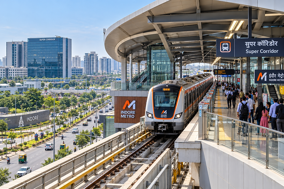
The Master Plan 2035 is built around metro connectivity as its backbone. Areas along the metro corridor — particularly the Super Corridor, AB Road stretch, and connecting arterial roads — are designated for higher-density development.
For homeowners and investors this means:
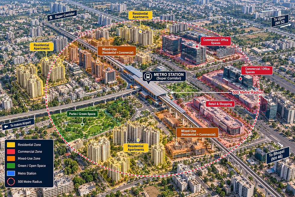
Properties within 500 metres of a metro station are in a Transit-Oriented Development (TOD) zone — higher FAR, mixed-use permitted, premium property values
If you're buying a plot near the metro line, the 2035 plan actively supports denser, taller construction there
If you're in a TOD zone and planning a single-floor home, you're leaving significant buildable value on the table
5. Green Infrastructure — New Restrictions in Some Areas
The Master Plan 2035 has a strong green infrastructure focus — advancing green infrastructure and sustainable techniques are among the key areas of development the plan looks into.</cite>
Practically, this means:
Areas near water bodies, the Saraswati River belt, and green buffer zones have construction restrictions — don't assume you can build on a plot near a nullah or lake without checking
Green building norms are expected to be mandated for larger projects in coming years
Solar provision is being encouraged in new construction — not yet mandatory for individual homes, but likely to become a factor in future approvals for larger projects
6. Peripheral Areas Are Now Part of the Plan — Rau, Mhow, Sanwer
One of the most significant changes in the 2035 plan is the expansion of Indore's planning boundary to include surrounding areas that were previously outside IMC or IDA jurisdiction.
Areas now covered or being brought under the 2035 plan:
Rau — rapid residential growth, now formally within the planning zone
Mhow — being integrated with Indore's urban planning framework
Sanwer and Depalpur corridor — industrial-residential interface being formalised
Pithampur — <cite index="4-1">the Pithampur Development Plan 2035 covers 65 villages across Indore and Dhar districts, with mixed-use, commercial, and residential zones formally designated along the corridor.</cite>
If you're buying or building in these areas, your construction must comply with the 2035 plan norms — not older village panchayat rules that may have previously applied.
What You Should Do Right Now
If you own a plot in Indore or surrounding areas:
Check your plot's current land use classification under the 2035 plan on the IDA or T&CP portal
Verify updated FAR and setback norms before finalising any building design
If your plot is in a newly designated zone (residential, mixed-use, TOD), you may have more buildable area than you think
If you're buying a plot:
The 2035 land use map is the most important document to check before buying — it tells you what you can legally build there
Plots on or near metro corridors, Super Corridor, and arterial roads planned in the 2035 plan are the high-appreciation bets for the next decade
Agricultural land being sold near Indore with promises of "future residential zone" designation needs verification against the actual 2035 plan map — not the seller's word
If you're starting construction:
Your architect must design to 2035 plan norms — not the old 2021 guidelines
IMC plan approval is now processed under the updated framework
Any deviation from the 2035 zoning is grounds for plan rejection or future legal complications on the property
Bottom Line
The Indore Master Plan 2035 is not a future document — it's the current reality governing every construction approval, plot purchase decision, and zoning question in the city right now. Homeowners who understand it make better decisions. Those who don't find out about it mid-project or when they try to sell.
If you're building in Indore and want clarity on how the 2035 plan applies to your specific plot and project, Shriketu Construction Pvt. Ltd. works with homeowners through this planning stage — before a single drawing is finalised.
Quick Reference
15,795 hectares for housing | New residential zones opened in peripheral areas |
Vertical development push | FAR likely higher near metro and arterial roads |
Mixed-use zone expansion | More flexibility for shop-cum-residence and commercial ground floors |
Metro TOD zones | Higher FAR, premium values within 500m of metro stations |
Green buffer restrictions | No construction near water bodies and green zones |
Peripheral areas included | Rau, Mhow, Sanwer, Pithampur now under formal planning norms |
Population target | 80 lakh by 2035 — city infrastructure and zones planned for this scale |



Comments